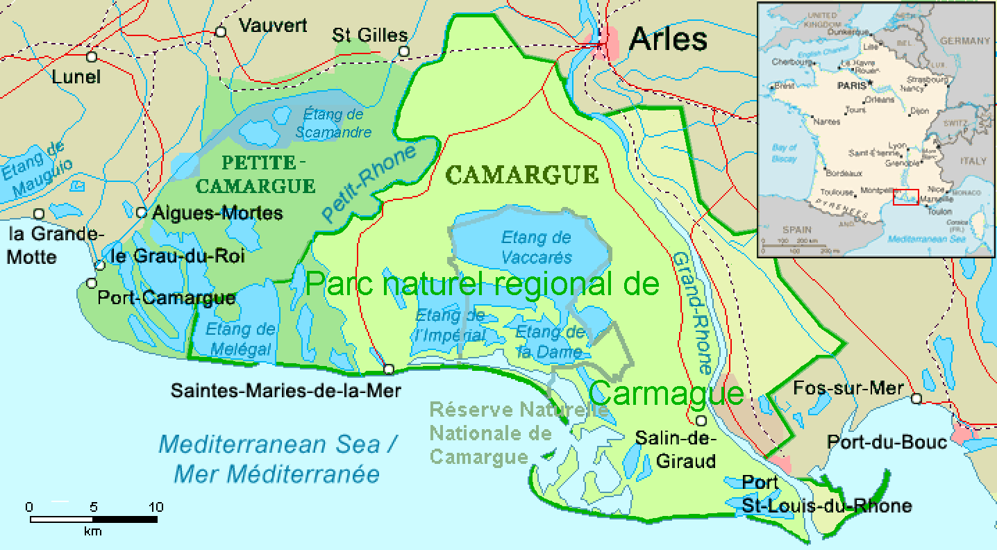
File:Camargue, Petite Camargue et Parc naturel reg.png
Dimension de sta anteprima: 800 × 441 pixel. Altre risołusion: 320 × 176 pixel | 640 × 353 pixel | 1 024 × 565 pixel | 1 436 × 792 pixel.
File orixenałe (1 436 × 792 pixel, dimension del file: 63 KB, tipo MIME: image/png)
| Descrision | ||||
| Data | revision 2016-11-21 | |||
| Provenjiensa | Combination of CIA World Factbook map (Image:Fr-map.png) and Demis Map Server (http://www2.demis.nl/mapserver/mapper.asp) data with additional annotations and modifications by self. | |||
| Autore | ChrisO, revision by Ulamm (discusion) | |||
| Altre version |
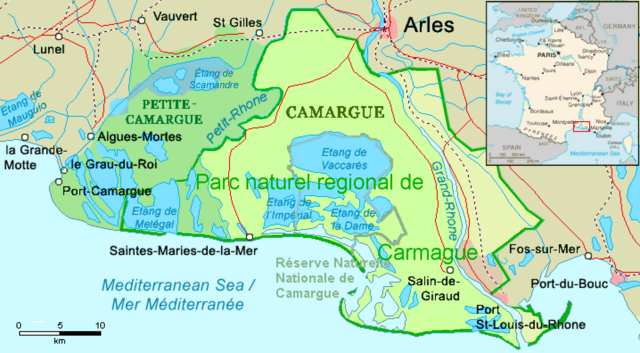
File:Camargue map.png (source)
|

Istoria del file
Schicia so on grupo data/or pa vedare el file come che el se presentava in tel momento indegà.
| Data/Ora | Miniadura | Dimension | Utente | Comento | |
|---|---|---|---|---|---|
| In ultima | 03:22, 1 dis 2016 | | 1 436 × 792 (63 KB) | Ulamm | name "Grand-Rhône" and the lower courses of Vostre & Vidourle rivers |
| 00:43, 22 nov 2016 |  | 1 436 × 792 (63 KB) | Ulamm | {{Information |Description= {{en|Map of the Camargue region, southern France}} |Source=Combination of CIA World Factbook map (Image:Fr-map.png) and Demis Map Server (http://www2.demis.nl/mapserver/mapper.asp) data with additional annotatio... |
Doparasion del file
Ła pajina che vien ła dopara sto file:
Doparasion globałe del file
St'altre wiki cua le dopara sto file:
- Uxo de ca.wikipedia.org inte le pàjine
- Uxo de de.wikipedia.org inte le pàjine
- Uxo de eo.wikipedia.org inte le pàjine
- Uxo de es.wikipedia.org inte le pàjine
- Uxo de eu.wikipedia.org inte le pàjine
- Uxo de fr.wikipedia.org inte le pàjine
- Uxo de ga.wikipedia.org inte le pàjine
- Uxo de it.wikipedia.org inte le pàjine
- Uxo de simple.wikipedia.org inte le pàjine
- Uxo de uk.wikipedia.org inte le pàjine
- Uxo de www.wikidata.org inte le pàjine