File:Census Regions and Divisions.PNG
Dimension de sta anteprima: 788 × 600 pixel. Altre risołusion: 315 × 240 pixel | 631 × 480 pixel | 909 × 692 pixel.
File orixenałe (909 × 692 pixel, dimension del file: 92 KB, tipo MIME: image/png)
Somario

|
This map has been uploaded by Electionworld from en.wikipedia.org to enable the |
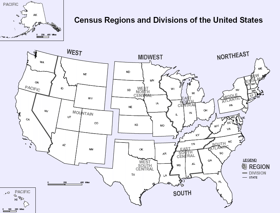
Map of U.S. Census Regions and Divisions. This map shows the four official US Census Regions, and the nine official Divisions within those Regions. See also: Image:US Census regional map.gif.
Licensa de doparasion:
Sto laoro el xe nel publico dominio nei Stati Unìi de la Merica parché el xe opera del Goerno Federal dei Stati Unìi secondo i termini del titolo 17, capitolo 1, sezion 105 del Codice USA. Varda anca Copyright par magiori informassion.
Ocio: la norma la se àplica solo ad opere prodote dal goerno federal e no dai singoli stati, teritori, commonwealth, contee, sudivision, munisipalità o qualsiasi altra sudivision dei Stati Unìi. No se àplica inoltre ai francoboli publicà da el United States Postal Service fin al 1978 (varda 206.02(b) of Compendium II: Copyright Office Practices).
|
 | |
| Questo file è stato identificato come libero da restrizioni conosciute riguardanti le leggi sul copyright, compresi tutti i diritti connessi e vicini. | ||

|
Ghe xe na version vetoriale de sta imagine ("SVG").
Te pol dopararla al posto de sta imagine raster co che xe necessaria na risolussion superiore. File:Census Regions and Divisions.PNG → File:Census Regions and Division of the United States.svg
Par savérghene piassè su la grafica vetoriale lèzi: Commons:conversion a SVG. Ghe xe anca informassion de suporto a le imagini SVG in MediaWiki. |
 |
Istoria del file
Schicia so on grupo data/or pa vedare el file come che el se presentava in tel momento indegà.
| Data/Ora | Miniadura | Dimension | Utente | Comento | |
|---|---|---|---|---|---|
| In ultima | 13:56, 9 nov 2023 | | 909 × 692 (92 KB) | Harold | Reverted to version as of 19:46, 13 June 2010 (UTC), COM:OW |
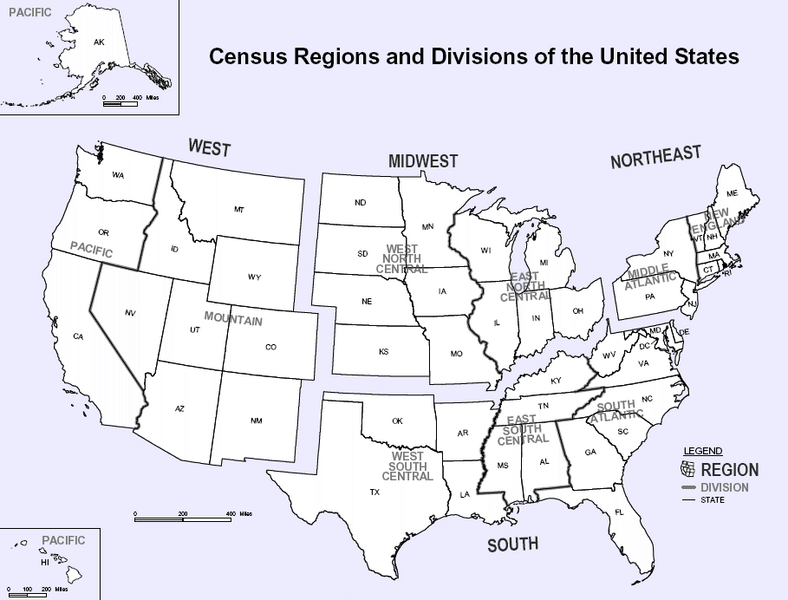
| 00:08, 4 set 2020 |  | 2 200 × 1 700 (103 KB) | ACupOfCoffee | Census regions were changed in 2013. | |
| 21:46, 13 xug 2010 |  | 909 × 692 (92 KB) | Ras67 | cropped, wm removed | |
| 00:11, 30 nov 2006 |  | 916 × 699 (107 KB) | Electionworld | {{ew|en|NThurston}} Map of U.S. Census Regions and Divisions. == Licensing == {{PD-USGov}} Category:Maps of the United States |
Doparasion del file
Ła pajina che vien ła dopara sto file:
Doparasion globałe del file
St'altre wiki cua le dopara sto file:
- Uxo de bn.wikipedia.org inte le pàjine
- Uxo de ca.wikipedia.org inte le pàjine
- Uxo de de.wikipedia.org inte le pàjine
- Uxo de en.wikipedia.org inte le pàjine
- Uxo de eo.wikipedia.org inte le pàjine
- Uxo de gl.wikipedia.org inte le pàjine
- Uxo de it.wikipedia.org inte le pàjine
- Uxo de ja.wikipedia.org inte le pàjine
- Uxo de ko.wikipedia.org inte le pàjine
- Uxo de nn.wikipedia.org inte le pàjine
- Uxo de ro.wikipedia.org inte le pàjine
- Uxo de simple.wikipedia.org inte le pàjine
- Uxo de sk.wikipedia.org inte le pàjine
- Uxo de tr.wikipedia.org inte le pàjine
- Uxo de vi.wikipedia.org inte le pàjine