File:Gales Bay.jpg
Dimension de sta anteprima: 800 × 536 pixel. Altre risołusion: 320 × 214 pixel | 640 × 429 pixel | 1 024 × 686 pixel | 1 280 × 857 pixel.
File orixenałe (1 280 × 857 pixel, dimension del file: 146 KB, tipo MIME: image/jpeg)
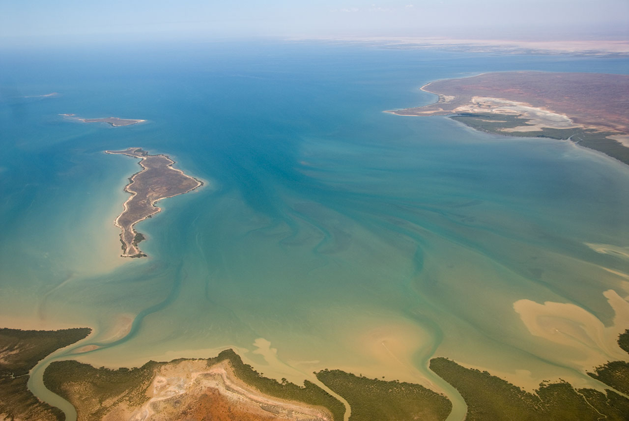
| Descrision | This is an aerial photograph of Gales Bay, a bay at the south end of Exmouth Gulf, Western Australia. The nearest foreground is Doole Island; behind it is Roberts Island; the further island is possibly Whitmore Island. The land on the right is the Sandalwood Peninsula. In the top right hand corner some of Giralia Bay can just be seen; across the top can be seen the continuing coastline of Western Australia. |
| Data | |
| Provenjiensa | https://www.flickr.com/photos/61952179@N00/366312114/ |
| Autore | Jon Hanson |
| Liçensa (Ridoparar sto file) |
Sto file el xe soto la licensa Creative Commons Atribusion-Condividi a lo stesso modo 2.0 Generico.
|
| Posission de la màchina fotogràfega | | La posission de sta qua e de altre imagini su: OpenStreetMap |
|---|
| This image, originally posted to Flickr, was reviewed on 18 May 2008 by the administrator or reviewer Kanonkas, who confirmed that it was available on Flickr under the stated license on that date. |
Istoria del file
Schicia so on grupo data/or pa vedare el file come che el se presentava in tel momento indegà.
| Data/Ora | Miniadura | Dimension | Utente | Comento | |
|---|---|---|---|---|---|
| In ultima | 14:20, 18 maj 2008 | | 1 280 × 857 (146 KB) | Hesperian | {{Information |Description=This is an aerial photograph of Gales Bay, a bay at the south end of Exmouth Gulf, Western Australia. The island in the foreground is Doole Island; behind it is Roberts Island; the further island is ''possibl |
Doparasion del file
Nisuna pajina ła dopara sto file
Doparasion globałe del file
St'altre wiki cua le dopara sto file:
- Uxo de ar.wikipedia.org inte le pàjine
- Uxo de arz.wikipedia.org inte le pàjine
- Uxo de ceb.wikipedia.org inte le pàjine
- Uxo de de.wikipedia.org inte le pàjine
- Uxo de en.wikipedia.org inte le pàjine
- Uxo de fi.wiktionary.org inte le pàjine
- Uxo de lt.wikipedia.org inte le pàjine
- Uxo de nl.wikipedia.org inte le pàjine
- Uxo de pnb.wikipedia.org inte le pàjine
- Uxo de ur.wikipedia.org inte le pàjine
- Uxo de www.wikidata.org inte le pàjine