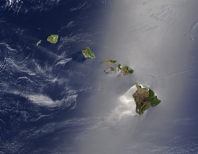
File:Hawaje.jpg

Dimension de sta anteprima: 771 × 600 pixel. Altre risołusion: 309 × 240 pixel | 617 × 480 pixel | 988 × 768 pixel | 1 280 × 996 pixel | 2 560 × 1 991 pixel | 3 600 × 2 800 pixel.
File orixenałe (3 600 × 2 800 pixel, dimension del file: 1,16 MB, tipo MIME: image/jpeg)
Istoria del file
Schicia so on grupo data/or pa vedare el file come che el se presentava in tel momento indegà.
| Data/Ora | Miniadura | Dimension | Utente | Comento | |
|---|---|---|---|---|---|
| In ultima | 20:19, 26 oto 2005 |  | 3 600 × 2 800 (1,16 MB) | Palladinus | Hawaii Islands |
Doparasion del file
Nisuna pajina ła dopara sto file
Doparasion globałe del file
St'altre wiki cua le dopara sto file:
- Uxo de arz.wikipedia.org inte le pàjine
- Uxo de bg.wikipedia.org inte le pàjine
- Uxo de ceb.wikipedia.org inte le pàjine
- Uxo de co.wikipedia.org inte le pàjine
- Uxo de en.wikipedia.org inte le pàjine
- Uxo de es.wikipedia.org inte le pàjine
- Uxo de fr.wikipedia.org inte le pàjine
- Uxo de fr.wiktionary.org inte le pàjine
- Uxo de gcr.wikipedia.org inte le pàjine
- Uxo de gl.wikipedia.org inte le pàjine
- Uxo de hr.wikipedia.org inte le pàjine
- Uxo de ky.wikipedia.org inte le pàjine
- Uxo de lv.wikipedia.org inte le pàjine
- Uxo de no.wikipedia.org inte le pàjine
- Uxo de oc.wikipedia.org inte le pàjine
- Uxo de pdc.wikipedia.org inte le pàjine
- Uxo de pl.wikipedia.org inte le pàjine
- Uxo de pl.wiktionary.org inte le pàjine
- Uxo de ro.wikipedia.org inte le pàjine
- Uxo de ru.wikipedia.org inte le pàjine
- Uxo de ru.wikinews.org inte le pàjine
- Uxo de sq.wikipedia.org inte le pàjine
- Uxo de sw.wikipedia.org inte le pàjine
- Uxo de to.wikipedia.org inte le pàjine
- Uxo de uk.wikipedia.org inte le pàjine


