File:New Zealand location map.svg

Dimensioni di questa anteprima PNG per questo file SVG: 475 × 599 pixel. Altre risołusion: 190 × 240 pixel | 380 × 480 pixel | 609 × 768 pixel | 812 × 1 024 pixel | 1 623 × 2 048 pixel | 1 928 × 2 432 pixel.
File orixenałe (file en formato SVG, dimension nominałi 1 928 × 2 432 pixel, dimension del file: 220 KB)
Somario
| Descrision |
Deutsch: Positionskarte von Neuseeland
Quadratische Plattkarte, N-S-Streckung 120 %. Geographische Begrenzung der Karte:
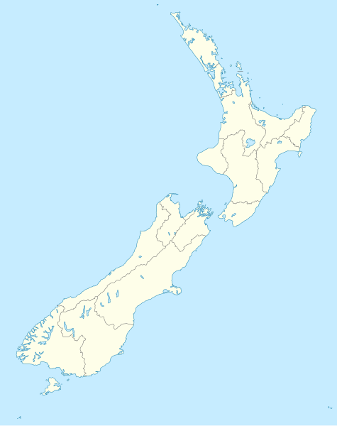
English: Location map of New Zealand
Equirectangular projection, N/S stretching 120 %. Geographic limits of the map:
Svenska: Plats karta över Nya Zeeland
Equirectangular projektion, N/S sträcker sig 120%. Geografiska gränser för kartan:
|
||
| Data | |||
| Provenjiensa |
own work, using
|
||
| Autore | NordNordWest | ||
| Altre version |
Derivative works of this file: |
||
| SVG sviluppo | Questa mappa in grafica vettoriale è stata creata con Inkscape, o con qualche altro programma.
|

Licensa de doparasion:
Mi, che detegno el dirito d'autor su sta opera, la pùblico qua soto le seguenti license:

|
Se autorixa ła copia, distribusion y modifegasion de sto documento soto i termani de ła liçensa de documentasion libara GNU, version 1.2 o calsiasi altra version dopo, publegada da ła Fonsasion par el Software Libaro; sensa sesion invariabiłi, testi de coertina e njianca testi de contro-coertina. Se include na copia de ła pena dita liçensa in te ła sesion intitołada Liçensa de Documentasion Libara GNU. |
Sto file el xe soto ła liçensa Creative Commons Atribusion-Spartisi in te ła stesa manjiera 3.0 Xenèrego.
- Te si libaro:
- de spartire in jiro – de copiar, distribuir e trasmétar sta opera
- de modifegar – de adatar sta opera
- Soto le seguenti condision:
- atribussion – Te ghe da atribuir ƚa paternità de ƚ'opera ne i modi indicà de l'autor o da chi te gà dà l'opera en lisensa, e en modo tale da no sugerir che lori i sia d'acordo con ti o col modo che te dòpari l'opera.
- spartisi in te ła stesa manjiera – Se te mis-ci, trasformi o dexviłupi sto laoro, te ghè da spartire łe to contribusion segondo ła stesa liçensa o na conpatibiłe a l'orixenałe.
Te połi segnare ła liçensa che te prefarisi
Istoria del file
Schicia so on grupo data/or pa vedare el file come che el se presentava in tel momento indegà.
| Data/Ora | Miniadura | Dimension | Utente | Comento | |
|---|---|---|---|---|---|
| In ultima | 18:05, 18 luj 2023 | | 1 928 × 2 432 (220 KB) | NordNordWest | Auckland corr |
| 19:15, 13 ago 2009 |  | 1 928 × 2 432 (376 KB) | NordNordWest | ||
| 22:22, 2 set 2008 |  | 1 928 × 2 432 (376 KB) | NordNordWest | {{Information |Description= {{de|Positionskarte von Neuseeland}} Quadratische Plattkarte, N-S-Streckung 120 %. Geographische Begrenzung der Karte: * N: 34.0° S * S: 48.3° S * W: 165.8° O * O: 179.4° O {{en|Location map of [[:en:New |
Doparasion del file
Ła pajina che vien ła dopara sto file:
Doparasion globałe del file
St'altre wiki cua le dopara sto file:
- Uxo de af.wikipedia.org inte le pàjine
- Uxo de als.wikipedia.org inte le pàjine
- Uxo de an.wikipedia.org inte le pàjine
- Plantilla:Mapa de localización Nueva Zelanda
- Auckland
- Queenstown (Nueva Zelanda)
- Arrowtown
- Rotorua
- Wanaka
- Matamata
- Mount Cook Village
- Christchurch
- Cambridge (Nueva Zelanda)
- Lake Tekapo
- Sky Tower (Auckland)
- Nelson (Nueva Zelanda)
- Tarras
- Te Anau
- Geraldine (Nueva Zelanda)
- Cardrona (Nueva Zelanda)
- Puent d'a badía d'Auckland
- Seu d'a Santisma Trinidat d'Auckland
- Seu de Cartón de Christchurch
- Puent penchau d'a foz d'o Kawarau
- Seu de Christchurch
- Seu d'o Santísmo Sacramento de Christchurch
- Wellington
- Uxo de ar.wikipedia.org inte le pàjine
Varda ła doparasion globałe de sto file.