File:Odisha locator map.svg

Dimensioni di questa anteprima PNG per questo file SVG: 607 × 600 pixel. Altre risołusion: 243 × 240 pixel | 486 × 480 pixel | 778 × 768 pixel | 1 037 × 1 024 pixel | 2 074 × 2 048 pixel | 2 269 × 2 241 pixel.
File orixenałe (file en formato SVG, dimension nominałi 2 269 × 2 241 pixel, dimension del file: 211 KB)
| Tìtuło |
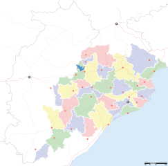
Orissa locator map |
||
| Descrizione |
Locator map for the Indian state of w:Orissa. Equirectangular projection - Geographic limits of the map: top=24.27, bottom=17.691 |
||
| Data | |||
| Provenjiensa |
Opara propia |
||
| Creator |
|
||
| Liçensa (Ridoparar sto file) |
Mi, che detegno el dirito d'autor su sta opera, la pùblico qua soto la seguente licensa: Sto file el xe soto ła liçensa Creative Commons Atribusion-Spartisi in te ła stesa manjiera 3.0 Xenèrego.
|
||
| Geotemporal data | |||
| Data rappresentata | seconda metà del XX sec. e XXI sec. | ||
| Georeferencing | If inappropriate please set warp_status = skip to hide. | ||
| Archival data | |||
| Note | Part of WikiProject India Maps | ||
Istoria del file
Schicia so on grupo data/or pa vedare el file come che el se presentava in tel momento indegà.
| Data/Ora | Miniadura | Dimension | Utente | Comento | |
|---|---|---|---|---|---|
| In ultima | 19:28, 6 set 2008 | | 2 269 × 2 241 (211 KB) | Planemad | |
| 15:28, 21 feb 2008 |  | 647 × 564 (132 KB) | Mkeranat~commonswiki | {{Information |Description=Locator map for the state of [w:Orissa] updated to show white borders for districts |Source=self-made, based on India locator map by [w:User:Planemad] |Date=Feb 2008 |Author= Mkeranat |Permission= |other_versions= }} | |
| 23:32, 14 feb 2008 |  | 647 × 564 (130 KB) | Mkeranat~commonswiki | {{Information |Description=Locator map for the state of [w:Orissa] |Source=self-made, based on India locator map by [w:User:Planemad] |Date=Feb 2008 |Author= Mkeranat |Permission= |other_versions= }} |
Doparasion del file
Nisuna pajina ła dopara sto file
Doparasion globałe del file
St'altre wiki cua le dopara sto file:
- Uxo de ar.wikipedia.org inte le pàjine
- Uxo de as.wikipedia.org inte le pàjine
- Uxo de awa.wikipedia.org inte le pàjine
- Uxo de ba.wikipedia.org inte le pàjine
- Uxo de ceb.wikipedia.org inte le pàjine
- Uxo de de.wikipedia.org inte le pàjine
- Uxo de en.wikipedia.org inte le pàjine
- Uxo de es.wikipedia.org inte le pàjine
- Uxo de fa.wikipedia.org inte le pàjine
- Uxo de gu.wikipedia.org inte le pàjine
- Uxo de hi.wikipedia.org inte le pàjine
- नलबण पक्षी अभयारण्य
- साँचा:ओड़िशा के लोकसभा निर्वाचन क्षेत्र
- आस्का लोक सभा निर्वाचन क्षेत्र
- भुवनेश्वर लोक सभा निर्वाचन क्षेत्र
- बलांगिर लोक सभा निर्वाचन क्षेत्र
- कटक लोक सभा निर्वाचन क्षेत्र
- ढेंकानाल लोक सभा निर्वाचन क्षेत्र
- जगतसिंहपुर लोक सभा निर्वाचन क्षेत्र
- जाजपुर लोक सभा निर्वाचन क्षेत्र
- कलाहांडी लोक सभा निर्वाचन क्षेत्र
- कंधमाल लोक सभा निर्वाचन क्षेत्र
Varda ła doparasion globałe de sto file.