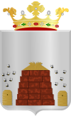
Hoogeveen
Hoogeveen el xe on comun dei Paexi Basi, situà inte ła provinsa de Drenthe.
| Hoogeveen (nl) | |||||
|---|---|---|---|---|---|
|
|||||
 | |||||
| Pozision | |||||
| Stato | Regno dei Paezi Basi | ||||
| Stato del Regno dei Paesi Bassi (it) | Paezi Basi | ||||
| Provinse dei Paexi Basi | Drenthe | ||||
| Capitałe | Hoogeveen (it) | ||||
| Popołasion | |||||
| Totałe | 55 603 (2021) | ||||
| Densità | 289,22 hab./km² | ||||
| Caze abitae | 23 601 (2015) | ||||
| Zeografia | |||||
| Àrea | 192,25 km² | ||||
| Altitùdene | 12 m | ||||
| Rente a | |||||
| Organizasion pułìtega | |||||
| Borgomastro de Hoogeveen | Karel Loohuis (it) | ||||
| Còdazi de identifegasion | |||||
| Còdaze postałe | 7900–7916, 7918, 7930–7931, 7933–7934 e 7936 | ||||
| Còdaze de matricołasion | D | ||||
| Fuzo oràrio | |||||
| Prefiso tełefònego | 0528 | ||||
| Sito web | hoogeveen.nl | ||||
|
| |||||
Evołusion demogràfega
canbiaAltri projeti
canbia- Wikimedia Commons el detien imàjini o altri file so Hoogeveen
- el detien schemi gràfeghi so
Linganbi foresti
canbia- (nederlandezo) Sito ufisałehoogeveen.nl. Sconosesta: nederlandezo (juto)
| Controło de autorità | VIAF (EN) 133679908 · GND (DE) 4396648-2 · WorldCat Identities (EN) 133679908 |
|---|
- ↑ Declarà da: waar staat je gemeente.nl.
- ↑ URL de refarensa: https://dans.knaw.nl/nl/over/organisatie-beleid/publicaties/DANSrepertoriumnederlandsegemeenten2011.pdf.


